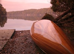
Another quick picture from Meech lake. Things got really pretty as the sun started to go down. I didn't want to leave but its easier to put the canoe away while there's still some daylight so I had to make tracks. I'll definetely have to head back before the ice sets in the lake..
Saturday, September 23, 2006

First day of autumn
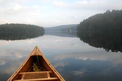
The forecast looked pretty wet this weekend so I didn't make any big plans. By midday Saturday it wasn't raining and looked pretty calm so I decided to grab my canoe gear, go pick up my boat and head up to the park for a paddle. It turned out to be a wise choice. It didn't rain a drop while I paddled around Meech lake. There was next to no wind and the canoe seemed to skim across the water with little or no effort. Okay there was some effort as my hands blistered up nicely from the paddle but it felt good regardless.
Things were pretty quiet up in the park. A few people on their cottage docks, one or two mountain bikers and a few people fishing. I guess the rest of the crowds followed the weatherman's advice and stayed indoors.... a mistake I won't make anytime soon. The loons are still around as well. I guess they head off a little later in the fall.
Things were pretty quiet up in the park. A few people on their cottage docks, one or two mountain bikers and a few people fishing. I guess the rest of the crowds followed the weatherman's advice and stayed indoors.... a mistake I won't make anytime soon. The loons are still around as well. I guess they head off a little later in the fall.
Saturday, September 16, 2006
Edmunds
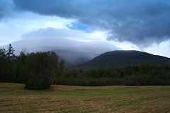
This was another photo leftover from the New Hampshire trip. I took it from the north side of the Presidential mountains. The clouds have (interestingly) enveloped the high summits while just to the west is an open blue patch of sun. Mt Washington is known for its strange, extreme weather. I guess the clouds "stick" on the tops of the peaks rather then just blowing along. At any rate it was kind of a cool sight so I took a photo. The rain clouds that day were pretty much everywhere and the cloud patterns changed by the minute. The "patch of blue" was very much the oddity on an otherwise rainy day. If you look very closely you can just see Edmunds col between Adams and Jefferson opening up through the clouds. Must have been pretty wet up there.
Big Slide
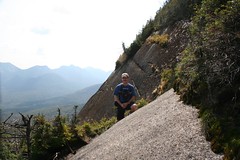
I came down with a wicked cold after last weekends hike to Big Slide in the Adirondacks. Missed a couple days work and am only now finally downloading my pictures. Big Slide was a nice hike. Did it with my friend Pete - who hasn't been down to the 'daks in quite a few years. It was a bit hazy in the valley but the trail goes up across three lesser peaks with lots of open ridgeline walking so it made for a nice outing. Unfortunately, just as we got to the summit - like inside of ten minutes! - groups of people also started to arrive. I counted about 12 people all told! Having seen 2 people all day this was a bit overwhelming. Ah well, I guess the outside world finds you no matter where you go for some solitude. Headed down the mountain and filled up my water bottle at JBL before making the walk out to the car. A great day on the trail (except for the summit :( ).
Burrits
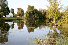
Went on a slightly more mundane trip this week. After last weekends trip I came down with a killer cold that knocked me out for a week. Still feeling the after effects, I decided I should rest up some more this weekend rather then sprinting off to distant mountains in a weakened state. I decided to go for a ride in the Marlborough forest which proved a good choice. The bugs are almost entirely gone and the trails are in good shape. Afterwards I stopped into the general store in Burrits Rapids for a soda. Went down to the canal and took this picture. Man, I wish I 'd brought my canoe. The water was really calm and looked incredibly inviting.... next time.
Wednesday, September 06, 2006
Alpine
Saturday night I camped near the Zealand pass. A nice little spot. I had prepared for the harsh rains of Ernesto to start falling through the night but they never came. Only Sunday morning when I stuck my head out of the tent did a light drizzle start to fall. I quickly packed up my gear and got driving and little by little the rain picked up. I guess the camping gods were with me today as nothing is worse then packing up in the rain so I dodged that bullet.
The cloud cover was low and the rain started to fall heavily so the hiking gods were against me. I was expecting this but had decided to hang out in NH and scout out some trailheads and camping spots for future trips. I even drove over to Grafton Notch in Maine to check it out.
The rain fell heavily all day and I didn't see any sign of clearing so after lunch I started to head for home. By the time I was near Montpelier in Vermont my legs were getting pretty stiff from being cramped in the car all day. I was driving right past Camels Hump and slowly a plan was hatched. Perhaps I should go and finish the LT. The last piece of the Long Trail(for me) was a 1 mile climb up to Camel's Hump on the North side. I had planned on waiting for a sunny day but it just seemed like the right answer. Get a hike in, stretch the legs, finish off the trail and still be home before too late. I had been saving this for the end to be a "glorious finish" on a sunny day but suddenly it didn't seem to matter. I just wanted to be done. So at 3:30pm I parked at Monroe state park and headed up the trail towards the summit.
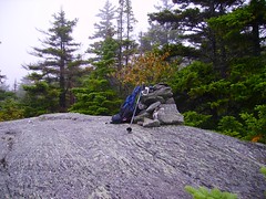
Before getting to the top I cut across (and back down) the Alpine trail to pick up the LT below the summit. This was where I had been turned back in '03 by deep slippery snows. The alpine trail would be a gorgeous walk but for the low level clouds I was in so no views today(as seen in this photo). Another excuse to return to this great mountain. Once on the LT I was hoping the "last mile" would be a chance to reflect on all the other hikes I had done on the trail. The camping, the day hikes, the friends I'd been with, the views (or lack thereof) etc. But it was not to be. The 1 mile of trail up to the summit is brutally steep and I was only barely able to keep moving while my heart and lungs tried to rip out of my chest. One last time the Trail got to dictate to me how it would be…. As it should be. As it had always been... no surprise I guess.
The cloud cover was low and the rain started to fall heavily so the hiking gods were against me. I was expecting this but had decided to hang out in NH and scout out some trailheads and camping spots for future trips. I even drove over to Grafton Notch in Maine to check it out.
The rain fell heavily all day and I didn't see any sign of clearing so after lunch I started to head for home. By the time I was near Montpelier in Vermont my legs were getting pretty stiff from being cramped in the car all day. I was driving right past Camels Hump and slowly a plan was hatched. Perhaps I should go and finish the LT. The last piece of the Long Trail(for me) was a 1 mile climb up to Camel's Hump on the North side. I had planned on waiting for a sunny day but it just seemed like the right answer. Get a hike in, stretch the legs, finish off the trail and still be home before too late. I had been saving this for the end to be a "glorious finish" on a sunny day but suddenly it didn't seem to matter. I just wanted to be done. So at 3:30pm I parked at Monroe state park and headed up the trail towards the summit.
Before getting to the top I cut across (and back down) the Alpine trail to pick up the LT below the summit. This was where I had been turned back in '03 by deep slippery snows. The alpine trail would be a gorgeous walk but for the low level clouds I was in so no views today(as seen in this photo). Another excuse to return to this great mountain. Once on the LT I was hoping the "last mile" would be a chance to reflect on all the other hikes I had done on the trail. The camping, the day hikes, the friends I'd been with, the views (or lack thereof) etc. But it was not to be. The 1 mile of trail up to the summit is brutally steep and I was only barely able to keep moving while my heart and lungs tried to rip out of my chest. One last time the Trail got to dictate to me how it would be…. As it should be. As it had always been... no surprise I guess.
The End
That said, the trail eased with a few meters to the hut clearing and then, through the trees… there it was. The actual finish of the trail(for me) was the Hut clearing just below the summit. I'd been here before so the actual climb up to the summit cone (1/4 of a mile) was a repeat but - on a nice day - it would have been a bonus and a nice way to finish. This last mile was closing the final gap for me on the trail. With one last step I walked into the clearing and finished the Long Trail. It was a pretty special moment. I took a few snaps and then layered up for the summit push. No views today but it was nice to go up none the less. Ernesto was screaming with wind as I broke above the tree line. I had to crawl the last 100 meters to the summit marker and then crawl back down to the scrubby trees which provided some shelter. Just before the treeline I stood up and screamed into Ernesto's face… but I (nor he for that matter) heard a sound.
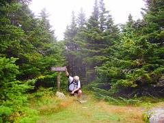
Back down to the hut clearing I started to head down to the car. It was 6 o’clock when I left so I was pushing darkness especially with the dark rainy conditions. I had my headlamp in my pack but on the bottom half of the trail I ran just to beat the impending dark. I signed out (with headlamp) and then had an LT ale to celebrate while I changed clothes at the car. The rain started to fall heavily so I was done just in time. Four hours later, a quick shower and I was in bed. All in all a successful weekend and I became an end-to-ender to boot.
Back down to the hut clearing I started to head down to the car. It was 6 o’clock when I left so I was pushing darkness especially with the dark rainy conditions. I had my headlamp in my pack but on the bottom half of the trail I ran just to beat the impending dark. I signed out (with headlamp) and then had an LT ale to celebrate while I changed clothes at the car. The rain started to fall heavily so I was done just in time. Four hours later, a quick shower and I was in bed. All in all a successful weekend and I became an end-to-ender to boot.
Tuesday, September 05, 2006
Moosilauke summit approach
Saturady brought a different challenge. After camping in Vermont at Gifford Woods (another favourite spot) I decided to head into the Whites to try a 4000 footer there. I picked Moosilauke as it had a bit of a mystic to it. It is one of the first really big mountains that the AT crosses as it comes into the Whites. Once on top, the AT thru-hiker can finally see the full White mountain range that they will be crossing for the next hard, long, painful week.
The drive was longer then I anticipated and I didn't get to the trailhead until close to 10:30. I chose a simpler approach then the AT trail, going up to the AMC/Dartmouth "Ravine lodge" east of the mountain. This would give me a relatively short approach on the gorge brook trail although I still had to climb some 2500 ft. Normally the Ravine lodge is open to hikers with bunkrooms and a kitchen but, when I arrived, it was closed for Dartmouth freshman orientation trips. I guess Dartmouth take their freshman hiking up and down mountains (with full packs) to welcome them to college - Nice! The lodge may have been closed but the parking lot was still open so I booted up and headed towards the summit. After getting lost (twice!) inside of the first 200m I finally found the Gorge brook trail and started on my hike. The trail itself started out in terrible condition but got better as I got higher. Huge boulders and rubble marked the early trail and lovely rock staircases met me higher up - strange. As I climbed I passed more and more groups. Some small (4 or 5 in a family) and some large (16 in a retiree backpacking group). Labour day weekend - and the only predicted nice weather day - had brought out hordes of hikers. I was surprised to find that most people here didn't know they should yield to faster hikers on the trail and I found myself trapped on narrow trails behind slower groups. Frustrating. The best behaved hikers were the Dartmouth kids (all in groups of 8 plus 2 leaders) whose leaders would yell out "hiker up!" and all the kids in their group would practically jump into the nearby trees to get out of my way. Perhaps a little excessive (okay, a lot excessive!) but I was glad for it compared to the "tourists" who just plodded along, glaring back at you, muttering "whose idea was this anyway.... vacation my #^#$^...." and not giving an inch.
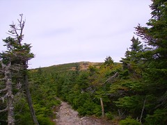
All in all though - despite the crowds - I really enjoyed this mountain. The trail led me up several switchbacks with great lookouts finally coming out on a false summit as seen in the photo with a view of the open bald summit ahead. I decided to change into a dry shirt here as the wind sounded strong up top (little did I know :-O ). To my surprise I could only see one hiker at the summit. Perhaps I would be lucky enough to sit up top in relative solitude? Not to be....
The drive was longer then I anticipated and I didn't get to the trailhead until close to 10:30. I chose a simpler approach then the AT trail, going up to the AMC/Dartmouth "Ravine lodge" east of the mountain. This would give me a relatively short approach on the gorge brook trail although I still had to climb some 2500 ft. Normally the Ravine lodge is open to hikers with bunkrooms and a kitchen but, when I arrived, it was closed for Dartmouth freshman orientation trips. I guess Dartmouth take their freshman hiking up and down mountains (with full packs) to welcome them to college - Nice! The lodge may have been closed but the parking lot was still open so I booted up and headed towards the summit. After getting lost (twice!) inside of the first 200m I finally found the Gorge brook trail and started on my hike. The trail itself started out in terrible condition but got better as I got higher. Huge boulders and rubble marked the early trail and lovely rock staircases met me higher up - strange. As I climbed I passed more and more groups. Some small (4 or 5 in a family) and some large (16 in a retiree backpacking group). Labour day weekend - and the only predicted nice weather day - had brought out hordes of hikers. I was surprised to find that most people here didn't know they should yield to faster hikers on the trail and I found myself trapped on narrow trails behind slower groups. Frustrating. The best behaved hikers were the Dartmouth kids (all in groups of 8 plus 2 leaders) whose leaders would yell out "hiker up!" and all the kids in their group would practically jump into the nearby trees to get out of my way. Perhaps a little excessive (okay, a lot excessive!) but I was glad for it compared to the "tourists" who just plodded along, glaring back at you, muttering "whose idea was this anyway.... vacation my #^#$^...." and not giving an inch.
All in all though - despite the crowds - I really enjoyed this mountain. The trail led me up several switchbacks with great lookouts finally coming out on a false summit as seen in the photo with a view of the open bald summit ahead. I decided to change into a dry shirt here as the wind sounded strong up top (little did I know :-O ). To my surprise I could only see one hiker at the summit. Perhaps I would be lucky enough to sit up top in relative solitude? Not to be....
Moosilauke summit
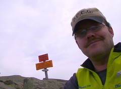
The summit of the mountain was an amazing scene. When I crested the summit the winds were howling (50mph - according to Mt. Washington weather station). It was difficult to stand and I quickly searched for some rocks to shelter behind. Much to my surprise every rock, nook and cranny had people cowering behind it. There was even some old stone wall foundations for a Hotel that sat up here in the 20's. It was sheltering hordes of Dartmouth freshman on the orientation trips (welcome to college!). Finally I spotted a small rock just beneath the summit sign that looked like I could fit behind. Sure enough, if I slouched down, it did the trick. I had some snacks and water and snapped this picture with the sign in the background. Comfortably out of the wind I set about counting the number of people on the summit. My guess was close to 50 although there could have been a few wormed into the rocks looking for shelter that I missed. More people were arriving by the minute so I decided not to hang around too long. Just before heading out I helped a couple take some pictures by the summit sign. It was a challenge getting them over to the sign (under full bore of the wind) and then snapping a shot. They even took a shot of me(with my camera)... but it seems my camera froze up at this point as I don't have the picture. Everything safely stowed back in my pack I headed down to the south summit.
carriage road to south summit
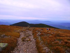
The route down was gladly beneath the summit crest and out of the wind. This made for an easy transit over to the South summit. The trail itself, the "Carriage Road", which I took down to the Snapper trail (about a mile away) - was fun across the ridge but had all the charm of a ski station Cat track as I descended from the mountain. It was wide, covered in loose rocks and steep as all get out. I guess - based on the name - that this trail was used to bring carriages of tourists up to the summit where the old hotel used to stand. At any rate it wasn't a lot of fun to descend but I would have really hated it coming up so I'm glad I chose the route I did. I took a slight detour to spend a little time on the South summit. It was considerably quieter then the Main summit and less windy as well. With a view of the rapidly approaching storms of Ernesto I decided to head down, go find a late lunch and look for a place to camp. On the way down the Snapper trail I was treated to a rock band playing at the Ravine Lodge. I could hear it when I was still close to 1.5 miles away. I guess the Dartmouth Freshman were having a party! I wasn't invited :( but it made for a nice soundtrack as I worked my way down the mountain.
Monday, September 04, 2006
LT
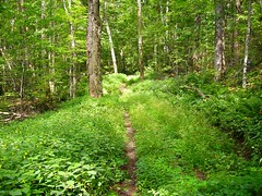
This stretch of the trail was pretty much entirely treed over. Not much to see but the trail itself looked pretty. That said all of these flowering bushes can be deceiving. Hidden amongst them are hordes of stinging nettles. I spent the good part of the hike dodging them as best I could. Alas I couldn't dodge them all and as a result got a lot of searing, itchy sensations on my legs. Frustrating! In spite of that it made for a nice walk and I finally got to cross the stretch of trail from US 4 to the Brandon Gap off my list. Only 1 more mile to go to complete the trail!!
After a lunch at my favorite deli I decided to try an afternoon hike. I went for Mendon - a peak on the New England 100 highest list. I had read a couple of reports about how to approach it and it didn't sound too bad. Alas, my memory failed me. Trying to remember what I had read I thought there were 3 crossings of the stream and then start bushwhacking at the first cairn.... but there were four crossings of the stream and several cairns?!? Check the GPS. Look at the topo. I figured I was in the right place but there didn't seem to be any signs of a good herdpath and things weren't adding up. At that point - tired from my first hike and wanting to get a campsite before they filled up - on this the long weekend Friday - I decided to pull up stakes and head back down the mountain. Without proper notes, only a GPS point for the summit and a vague recollection of details regarding the bushwhack I decided to come back another day better armed to tackle this mountain. I felt a bit defeated but learned important lessons and will "get" to come back for another great hike in this area - never a bad thing.
After a lunch at my favorite deli I decided to try an afternoon hike. I went for Mendon - a peak on the New England 100 highest list. I had read a couple of reports about how to approach it and it didn't sound too bad. Alas, my memory failed me. Trying to remember what I had read I thought there were 3 crossings of the stream and then start bushwhacking at the first cairn.... but there were four crossings of the stream and several cairns?!? Check the GPS. Look at the topo. I figured I was in the right place but there didn't seem to be any signs of a good herdpath and things weren't adding up. At that point - tired from my first hike and wanting to get a campsite before they filled up - on this the long weekend Friday - I decided to pull up stakes and head back down the mountain. Without proper notes, only a GPS point for the summit and a vague recollection of details regarding the bushwhack I decided to come back another day better armed to tackle this mountain. I felt a bit defeated but learned important lessons and will "get" to come back for another great hike in this area - never a bad thing.
LT moose
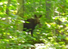
Started out my weekend with a section of the Long Trail that I had to complete. Just a 2 or 3 mile stretch down near Chittenden. Unfortunately it didn't have much to offer in terms of views so I wasn't looking forward to it but I guess you have to hike it all to say you're and "end to ender". It actually turned out to be a beautiful day. The trail itself was non-descript but it was a nice day for a walk. Along the way I turned a corner and met this "professional hiker". She was standing in the trail not a few feet in front of me. Perhaps I was so surprised that - even though I had time to get out my camera the shot ended up pretty blurry. It could be just about anything in the photo - maybe even Bigfoot? No chance to take a better shot though. As soon as I moved - just a step - she took off up the trail not to be seen again.
Sunday, August 27, 2006
Marcy dam
Did a short hike today. Well, that's not really accurate as I covered 13 miles or so. It was mostly easy walking and I was done by 3pm so it felt short. I did manage to get up two peaks so I still accomplished something.
I had planned to meet Mike and do something more ambitious but the prior Tuesday I tweaked some muscles in my back. Any movement resulted in blinding pain and I was forced to spend 24 hours flat on my living room floor(p.s. the ceiling needs painting). Strangely I was feeling much better the next day and by Saturday I 'felt' almost 100%. That said, I didn't want to attempt a huge trek deep into the bush only to reinjure my back. As a result, I opted out of Mike's plans and went for a shorter hike on my own. Phelps and Tabletop fit the bill. The route meant I was never too far from my car so, if I had a problem, I could always cut it short without spoiling someone elses day. Also the climbs aren't too fierce so I wouldn't be requiring a major effort. A further benefit was that the van Hovenberg trail is busy (really busy) so, should I require emergency assistance(hopefully not!), I'm not without the means of finding some help. The more remote trails Mike had planned on could mean a long, long... long wait before someone should happen along.
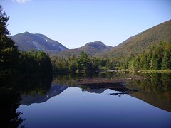
With the plan set I headed to South Meadow and walked up the truck trail to Marcy dam. This also gave me a nice stroll to warm up the back muscles before calling for more rigourous climbing. All went well. A nice morning and I was feeling good. Got to Marcy dam at 8:30 and the water was perfectly still. Made for a nice shot of the Avalanche pass in the background. From there it was off to Phelps and I was still ahead of the crowds on the van Hovenberg!
I had planned to meet Mike and do something more ambitious but the prior Tuesday I tweaked some muscles in my back. Any movement resulted in blinding pain and I was forced to spend 24 hours flat on my living room floor(p.s. the ceiling needs painting). Strangely I was feeling much better the next day and by Saturday I 'felt' almost 100%. That said, I didn't want to attempt a huge trek deep into the bush only to reinjure my back. As a result, I opted out of Mike's plans and went for a shorter hike on my own. Phelps and Tabletop fit the bill. The route meant I was never too far from my car so, if I had a problem, I could always cut it short without spoiling someone elses day. Also the climbs aren't too fierce so I wouldn't be requiring a major effort. A further benefit was that the van Hovenberg trail is busy (really busy) so, should I require emergency assistance(hopefully not!), I'm not without the means of finding some help. The more remote trails Mike had planned on could mean a long, long... long wait before someone should happen along.
With the plan set I headed to South Meadow and walked up the truck trail to Marcy dam. This also gave me a nice stroll to warm up the back muscles before calling for more rigourous climbing. All went well. A nice morning and I was feeling good. Got to Marcy dam at 8:30 and the water was perfectly still. Made for a nice shot of the Avalanche pass in the background. From there it was off to Phelps and I was still ahead of the crowds on the van Hovenberg!
Algonquin
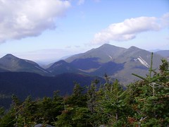
The climb up Phelps was steady but not too technically difficult. It opens up to some nice ledges on the summit which provide these great vistas. I was up by 9:30 am so things were ticking along well. I had a snack and a little drink and then headed down and off towards Tabletop. Started to run into the crowds as I headed down and the Van Hovenburg trail was a bit of a zoo. Lots of folks headed to Marcy today.
The climb up Tabletop was steep but short (and really quiet). Very eroded and a lot of roots exposed. Not sure that bodes well for the trail. I would guess that the trees along the trail - roots washed from the soil will come down easily in winter storms leaving more and more blowdown to be cleared.... causing more erosion, causing more blowdown.... a bit of a vicious cycle.
The Tabletop summit was unremarkable. Mostly in the trees although there was a little view over to the Johns Brook valley beyond the top. I spent a few minutes here and then headed off to Indian Falls for lunch.
The climb up Tabletop was steep but short (and really quiet). Very eroded and a lot of roots exposed. Not sure that bodes well for the trail. I would guess that the trees along the trail - roots washed from the soil will come down easily in winter storms leaving more and more blowdown to be cleared.... causing more erosion, causing more blowdown.... a bit of a vicious cycle.
The Tabletop summit was unremarkable. Mostly in the trees although there was a little view over to the Johns Brook valley beyond the top. I spent a few minutes here and then headed off to Indian Falls for lunch.
indian falls
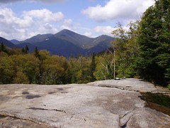
I stopped at Indian Falls to have lunch. I had it mostly to myself which is a rare treat. A few people stopped by but they didn't stay long. I pumped a couple of bottles of water and enjoyed the view for 45 minutes or so. A great spot. Many years ago Mark and I camped here and cooked dinner on the rocks above the Falls. Unfortunately they don't allow camping at this spot any more. Too heavy an impact on this fragile environment I suppose. You can still see the camp sites clearly in the woods along the trail. At one point - long before my time - there were also leantos here. I guess Mother nature will close up those clearings over time and return them to the dense forest that surrounds this area.
After lunch I headed down to the Avalanche camps, back to the Dam and out to the car. I debated heading up Colden as it was only 1pm and the mountain is really close from here but with my back issues I decided not to press my luck. Another excuse to come back to this gorgeous area...
After lunch I headed down to the Avalanche camps, back to the Dam and out to the car. I debated heading up Colden as it was only 1pm and the mountain is really close from here but with my back issues I decided not to press my luck. Another excuse to come back to this gorgeous area...
Thursday, August 10, 2006
Summit of Saddleback
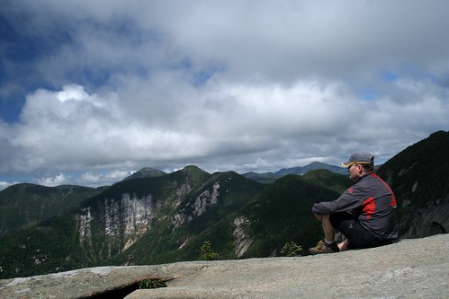
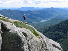
Mike sent a few photos from the trip. Since he doesn't blog I figured - with due credit - that I would post them here. This is the summit of Saddleback with me standing on a nearby boulder. Down below is the Upper Ausable lake and the Colvin-Blake range behind. Nice shot showing how lucky we were with the weather. A beautiful day indeed.
climbing basin
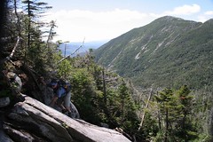
This shot is one of mine. Mike is climbing up the trail to Basin with handy roots for hand holds. The trail was pretty steep in spots but unlike Saddleback you were almost always in the trees so you never felt too exposed. Haystack in the background looked really nice. We could see people hiking along the ridge. I must say - from here - it looked really easy to see them bounding along the ridge but of course I would find out it was not so speedy on Sunday when I made my way up Haystack.
Climbing Saddleback
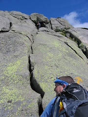
This is a great shot of the climb up Saddleback. While it looks steep (and it is) there are easy crags to negotiate up to the safety of the next ledge. Mike (below) is standing on safe flat ground and I (above) am also on a nice ledge. The crack to the right has some nicely positioned rocks which allow for easy progress up from one ledge to another. The painted arrows help guide you so you don't end up in a "dead end" position where there are no easy ways up forcing you to down climb to refind the path. Great fun!
Haystack summit
Sunday came around and decisions were to be made. The guys had been telling me - for months it seems - all about their great hike last year to Haystack. Of course on Sunday they wanted to go up Mt. Marcy (a peak I’d been to)..... but I wanted to do Haystack !!! Actually it worked out really well. We were able to follow the same trail approaching these two mountians for most of the day. In the col between the two peaks I went left (to Haystack) and they went right (to Marcy). After my climb I went back down the col and then almost to the top of Marcy where I met the guys coming down and we then hiked back to the lodge. In the end we only hiked seperately for maybe 2 hours and we all got to do the peak we wanted so it worked out great.
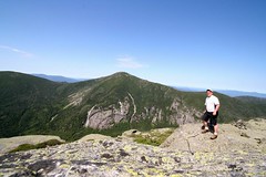
Haystack has to be the one of the best hikes I've done in a long time. It is centrally located amongst a large group of the high peaks and the last 3/4 of a mile are above treeline with nice rock scrambles to the summit. I arrived on the summit completely alone. I had my lunch, took photos, dried my socks out and then finally packed up and headed down. Only then did I meet a group heading for the top.
In contrast, Mt Marcy - the highest mountain in NY - has a more gradual climbing trail and draws big crowds on a sunny day. Today was no exception. Once I got over to the Marcy trail it was like merging onto a superhighway. There was such a variety of people marching to the top. Some poorly equipped but all wanting to climb the highest peak. Families (their children toting teddy bears), college kids in running shoes, a kindly grandmother (who left clothes pins at the trail junctions to tell her "slower husband" which way she went(?)), young couples having heated discussions (because one was hell bent on summiting and the other "just wanted to go home!"). Dozens of people on the summit - it was a real zoo!! It certainly made for a contrast to my solo walk on Haystack just a short distance away.
That said it was a perfect day out and one I won't soon forget. We all made it back to a Mexican feast at the lodge and were in our bunks asleep by 9:30. A great weekend overall.
Haystack has to be the one of the best hikes I've done in a long time. It is centrally located amongst a large group of the high peaks and the last 3/4 of a mile are above treeline with nice rock scrambles to the summit. I arrived on the summit completely alone. I had my lunch, took photos, dried my socks out and then finally packed up and headed down. Only then did I meet a group heading for the top.
In contrast, Mt Marcy - the highest mountain in NY - has a more gradual climbing trail and draws big crowds on a sunny day. Today was no exception. Once I got over to the Marcy trail it was like merging onto a superhighway. There was such a variety of people marching to the top. Some poorly equipped but all wanting to climb the highest peak. Families (their children toting teddy bears), college kids in running shoes, a kindly grandmother (who left clothes pins at the trail junctions to tell her "slower husband" which way she went(?)), young couples having heated discussions (because one was hell bent on summiting and the other "just wanted to go home!"). Dozens of people on the summit - it was a real zoo!! It certainly made for a contrast to my solo walk on Haystack just a short distance away.
That said it was a perfect day out and one I won't soon forget. We all made it back to a Mexican feast at the lodge and were in our bunks asleep by 9:30. A great weekend overall.
Tuesday, August 08, 2006
Johns Brook Lodge
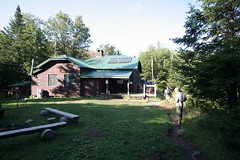
Spent the weekend at John's Brook Lodge in the heart of the Adirondacks. Truly an amazing place run by the ADK hiking club. Bunks and 3 meals a day are provided for a minimal fee which allows you to be situated in the heart of some amazing hiking trails. Mike, Mark and I went in on Friday and came out on Monday after two stunning days of climbing peaks. The weather - unlike my previous two trips to the 'Daks was gorgeous. Almost no clouds, warm - but not hot -, and a nice breeze as you worked your way out onto the summits.
The lodge crew cooks a big breakfast and provides a bag lunch for the trail. Dinner is on the table at 6:30 motivating hikers to come down off the peaks before nightfall. On the nights we were there, there were a few latecomers struggling back from over ambitious hiking agendas but no one went hungry as food was saved for all. All you need to bring in - other than day hiking gear - is a sleeping bag and clothes to last your stay. The food was great and in more then ample supply.
Perhaps the only drawback - and I'm stretching here - is that the only facilities to wash off in after a long sweaty outing is Johns Brook itself. The water temperature was probably in the mid 40's F which made for a bracing (invigorating?) bath! The cold water was beautiful to sink your feet into after a long day of hiking. In a few moments your feet went numb from the cold which is an incredibly good thing!
The lodge was also a great place to meet up with the fellow hikers staying the night and gather "intel" on our proposed routes as well as sharing any advice we had to offer. We even got to meet the ADK chairman of the JBL lodge committee who was up for a couple of days. He had endless stories of the lodge, the trails and his days in the woods. He even gave a slide show showing the lodges early days and how they outfit the lodge every spring with a helicopter fly in of supplies.
The lodge crew cooks a big breakfast and provides a bag lunch for the trail. Dinner is on the table at 6:30 motivating hikers to come down off the peaks before nightfall. On the nights we were there, there were a few latecomers struggling back from over ambitious hiking agendas but no one went hungry as food was saved for all. All you need to bring in - other than day hiking gear - is a sleeping bag and clothes to last your stay. The food was great and in more then ample supply.
Perhaps the only drawback - and I'm stretching here - is that the only facilities to wash off in after a long sweaty outing is Johns Brook itself. The water temperature was probably in the mid 40's F which made for a bracing (invigorating?) bath! The cold water was beautiful to sink your feet into after a long day of hiking. In a few moments your feet went numb from the cold which is an incredibly good thing!
The lodge was also a great place to meet up with the fellow hikers staying the night and gather "intel" on our proposed routes as well as sharing any advice we had to offer. We even got to meet the ADK chairman of the JBL lodge committee who was up for a couple of days. He had endless stories of the lodge, the trails and his days in the woods. He even gave a slide show showing the lodges early days and how they outfit the lodge every spring with a helicopter fly in of supplies.
Subscribe to:
Posts (Atom)