This past weekend had been reserved as the first “work weekend” of the season for the Adams firetower. It’s not a long weekend in the US so it seemed like a good one to circle for the Americans. For me it was a good plan as well. With the long weekend I could spend one day on the tower and then go for a hike on Sunday before returning home to spend Monday gearing up for the busy week ahead. As it turned out, the “work weekend” got canceled so I was at loose ends. I still figured I would head down to the Adirondacks but wasn’t sure where I’d go.
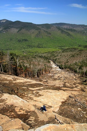
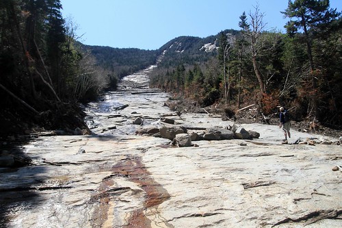
 Finding the slide proved no problem - it "ripped" right through the trail!
Friday morning Mike dropped me a last minute note suggesting he was going to check out Bennies Brook slide and that sounded like too good a route to miss out on so a plan was quickly hatched! I've only climbed one slide before - the relatively easy slide up Macomb so this would be an interesting challenge. I’d checked out Bennies brook slide a couple of winters ago. It’s colloquially known as the “root canal” slide as it looks just like the nerve ending of a tooth… and it sits in the middle of Lower Wolfjaw mountain. At that time it was a little narrow for my liking to ski (10 or 12 feet wide at most near the bottom). It was also choked with a lot of loose debris and I figured it would take a lot of snow to cover it well. On the plus side there was a lot of “glades” off the slide which looked much more tempting. After Irene swept through last fall a number of slides got face lifts – amongst them was Bennies Brook - so I was eager to go check it out and see if things had improved.
 The ledges are never too intimidating despite getting steep near the top
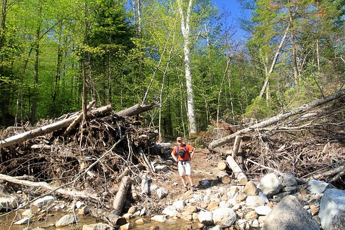
From the Garden trail head we took the Southside trail up the John’s brook valley. This was the most direct route and it was new to me so it sounded interesting. the first part involves actually crossing the brook to the south side and the initial “rock hop” proved a little more challenging than we anticipated. lots of rocks but each route we scouted had at least one 8 or 9 foot jump breaking up an otherwise easy crossing. Finally though we finally found a good spot and made it across. From there it was up the trail which seemed to also have suffered at the hands of Irene. One spot had been washed completely away by the brook and a rudimentary bushwhack had been worked in to get around this challenge. The brook itself was beautiful with all the rocks having been washed (polished?) clean by the rushing water.
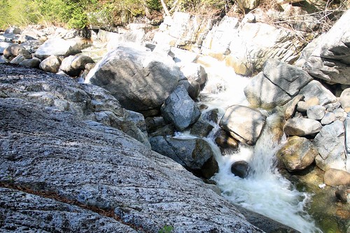 White polished rocks in the John's brook
Finding the slide proved no problem as it had run right through the trail! When we arrived we saw immediately that Irene had done some remodeling since I had been here last. What was a narrow little channel (well above the trail) was now 30 or 40m across. Huge trees had been ripped out by their roots and left on the banks. There wasn’t much of a debris pile left at the base of the slide as it had made it all the way down to the John’s brook which then washed it away - much to the chagrin of the residents down stream.
 The grade gets steeper
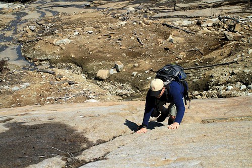 Finally steep enough to warrant 3 points of contact - but lots of seams to support the climb
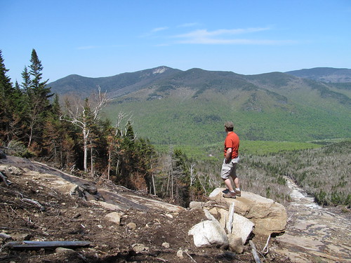
We started our way up and going proved slow. Not so much because it was hard but because there was so much to see! Lots of exposed rock, lots of destruction and the views just got better and better the higher we went. When we finally pushed up the last steep wall, the whole of the John’s Brook valley spread out behind us – lots of photo stops were called for and more than a few “rest stops” (needed or otherwise) to take in the views. Initial climbing was pretty easy. Pick a path through the debris and occasionally come to a little ledge to clamber up. Higher up it became a bit of a chess game – looking for the best line and trying not to get “cliffed out”. The top half was a real treat with lots of scrambles that were never very difficult. Only when we reached the final head wall itself (near vertical) did we find ourselves forced to exit the slide and whack to the ridge trail on top. The whack was pretty short and too soon we were on top of Lower Wolfjaw. From there we came down the usual steep, slippy trails all the while noting that the views in the woods were nothing compared to the middle of the slide. I can imagine the slide will become the defacto route to climbing Lower Wolfjaw in the future. What was once a bit of a low rate peak with limited views from the summit now has a 5 star route to the top. From a skiing perspective I can see the slide being a busy spot. The skiing should be excellent in here now with a wide open drainage and lots of room to make turns.
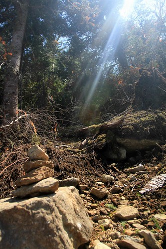 Wasn't hard to spot the exit cairn - it was bathed in sunlight!
Long slog out to the car and a great day in the woods complete. Only downer was that I “creased” the rear bumper of the car when I backed into a tree (D’oh!!!) Ah well, with pleasure must come pain. As usual, there are lots more photos here. Great way to relax in the woods before the busy week ahead getting ready for Race Weekend.
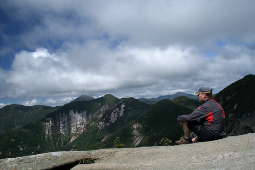
 One last chance to enjoy the view (photo by M.Price)
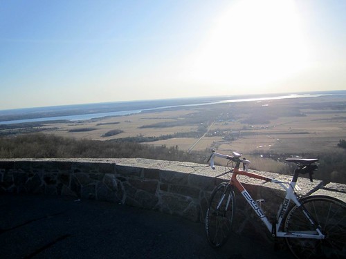 A rare sunny evening ride on the Gatineau Parkway
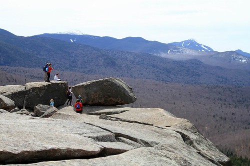 Some nice erratics on Pitchoff's false summit
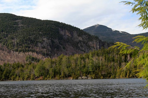 A nice little leanto on the pond - with Whiteface looming overhead
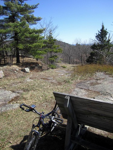 Nice spot to relax at the Pontiac lookout
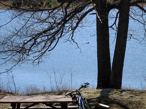 Loons come for a visit as I relax at Lusk cabin