 From the beginning of this effort to hike all 46 high peaks in the Adirondacks, Allen has always stood out as a potential deal breaker. I’ve looked at maps, studied online trail reports, read guide books and kept coming to the same conclusion - this one is a little daunting. It’s not an impossibly long hike. It’s not overly tall or hellishly steep… but its just kind of… “out there”. Last weekends hike to Cliff and Redfield is in fact longer – Allen being something less than 30km. Last weekends hike had more vertical elevation gain (Even Cascade - potentially the easiest - has more elevation gain!). But Allen sits off by itself with access along a lonely herdpath deep into the wilds of the park. Last weekend I hiked from Adirondack Loj through Avalanche pass, by Lake Colden and up the Oplalescent. I hiked with literally hundreds of other people on the trail and passed 2 ranger interior outposts – never far from help if anything were to go astray. Allen – ummm, not so much. No campers, no real campsites per se and certainly no rangers. I met only 2 other hikers all day (doing Allen as well). From the minute you step out of the car you are headed away from the popular trails of the high peaks and into the wild, away from civilization…. And that can be unnerving when you are looking at the map. And so over the last three years I avoided it while debating possible strategies. Maybe it would be better to ski part of it in the winter?… no, too cold and maybe not enough snow, maybe an early summer hike would be best?… no, too wet and muddy, perhaps late summer?… No, too hot, Fall?… rife with hunters - too risky, maybe a winter ski… no etc. etc. Now I was down to 2 last peaks on “the list”. I’ve saved Dix mountain for the last, so that leaves me to face Allen. No more chances to avoid it, procrastination has worked its magic.
  I hadn’t really expected to head back to the high peaks so soon after last weeks long hike to Cliff and Redfield. I usually take at least a week off in between hikes but as I rode my bike on Saturday I thought that maybe the time had arrived to go get this peak. The weather forecast looked good (a rarity for this summer) so I decided to load up and drive down Saturday afternoon - to the same campsite I had last weekend. I wanted to get started early as the day was slated to be a warm one. With luck I could get to the mountain and up it before it got too hot. At 5 am I woke up to pitch blackness. Hmmm, shorter days, fall must be coming. Hit the snooze but couldn’t sleep so I loaded my pack, booted up, had a quick bite and headed for the trail head. Signed in at quarter to 6 and stepped into the dark woods. Almost immediately I crossed a couple of bridges and could see a heavy fog on the lakes – cold (maybe 12C)… fall must be coming.
  The approach trail to Allen although long, is pretty easy going (read flat) and, as it turns out, a good portion of it follows old gravel roads past an abandoned mine and up through a hunting clubs property (with permission). The going was fast and soon I had reached the Opalescent brook. While there is usually a bridge across, this past winters heavy snow run off took the bridge out so the hunting club had kindly marked a good spot to ford the creek without losing the trail. I took my boots off to keep them dry and carefully waded across (knee deep at worst) the very cold brook. Beyond the creek but still on the flat I entered a large area where hurricane Floyd had taken down a huge tract of forest. Now a decade later the loose scrubby bush has started to slowly regenerate. Unfortunately it’s quite overgrown and early in the morning this meant it was wet from the dew. After a mile of walking through this I might as well have walked through the brook as my boots were now soaked. Finally I was back into some real forest and in a couple more miles and I arrived at the bottom of the mountain. I may have covered a lot of ground but there was no real concern of directions – totally clear trail and well marked intersections. I may have been a long way “out there” but there was no threat of being lost.
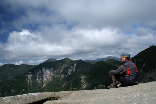
  The climb up Allen goes along (and sometimes in) the Allen brook. Its steep… really steep at times. To add insult to injury the Allen brook is home to a rare form of red/brown algae that grows on the rock surface. This algae – unlike other more typical algae found in the park – is incredibly slippery when wet. It is also incredibly slippery when dry(!) so there’s no winning. Instead you have to make careful foot placements and slowly work your way up. Finally, after crossing a small slide you leave the brook (and algae) behind and make one last push up to the summit ridge and then a short easy walk to the summit sign. I’m here(!) and there is even a little bit of a view carved out of the nearby trees. I sat down and had some lunch and looked at the map… and was immediately intimidated at where I was now sitting… but it hadn’t been that bad to get here so maybe the way out would be okay. After a half hour of lunch and picture taking (and rest) I started down the tricky descent and – too my surprise – was down much faster than I anticipated… and no giant outta control slides down the algae covered rocks. Met the only two people I would see all day at the base and gave them some beta on the climb before going our separate ways.
  The walk out was a long connection of milestones that I could remember from the trek in and one by one I got closer to home. The walk across the open area where floyd had cleared the forest was now unbearably hot – no shade to be had and my GPS suggested 34C… but its in a black shell so I don’t know how accurate it is. On the plus side the brush was now dry and I spotted lots of berries (blue, rasp, black etc) along the trail so there was lots of trailside snacking to be had. The ford across the stream now felt decidedly warmer than in the morning but was plenty welcome on the feet. A few more miles and I was back at the car. Quick swim in the Hudson river and I was cleaned up and ready to go…. and it was only 3:30!! This demon hike, this deal breaker, this hellish ordeal…. As it turns out it wasn’t even a long day! I guess that’s a lesson we all need to remind ourselves from time to time. The mind can often make more of something if given the time to do it. This hike is by no means the hardest hike I have done and I’d probably do it again on a nice fall day. It was certainly a treat to get so much solitude after last weekends super highway of hiking trails. It’s “out there” to be sure… but sometimes it’s nice to go “out there” if only to test the waters. Monday morning I got up… no sword hanging over my head… now I can enjoy the fall hiking season.
Allen - 45 of 46


6 comments:
You'd go again on a fall day? Great cause I wasn't keen on heading in there solo!
Hey, I'm gonna need to hike to it 3 more times to fill in my "all season" grid. Ha, ha, ha, ha, ha, ha,...
I have a hard enough time keeping up on foot but on skis...forget it
great trip report. funny how many people report allen all different ways. you made it sound enjoyable, some reports on allen are scary. where did you camp?
Hi Corin; I too thought Allen was scary(based on previous reports) but in the end it wasn't that bad. It's a long walk to be sure and all "away" from the popular hiking areas ... and there are no bail out points - just out and back. That said it's a nice walk through varied countryside so if you don't mind a long day then this one isn't so bad. I can think of a few worse ones...
Where did I camp? kind of a secret ;-) There are a few legal car camping spots off a side road just south of Newcomb and the Upper Works road. Put's you a short drive from the trailheads along Upper Works which allows for an early start - something which is useful when you are doing Allen or the Santas as a day hike.
Post a Comment