Monday, October 06, 2008

Finishing the 46

Well the time had finally come. Time to climb Dix mountain and complete the list of 46 high peaks in the Adirondacks. Last weekend was a bit of a washout with low cloud cover and potential for a lot of rain so I bumped it up to this weekend. This meant that some of the guys I had invited along couldn’t make it but some others were now available so I was glad to have some company along for this “last” of hikes. The weekend started off badly as I got the word that a lot of snow had fallen on the high peaks – would that end my chances for the season? Nothing for it but to press on and see what the day would bring. Pete and I decided to head down Saturday afternoon and camp at Wilmington notch. Second strike? I forgot the tent poles that were in my workshop drying out after last weekend. No matter, we conjured up a nice leanto with our hiking sticks and the tent fly and soon had a workable sleeping structure…. But what would be next to go wrong? Over night the temperatures dipped below zero but Pete and I slept soundly in our sleeping bags and woke just before sunrise to prepare for the hike ahead. Indeed, as we drove down to the trailhead, Marcy and Algonquin were well coated with snow but Dix looked to have fared better with just a dusting of snow. Things were looking up.

Mike joined us at the trailhead after spending a comfy night in a motel in Saranac Lake (He’s not a camper… yet) but he was suffering from a bit of a sinus cold and was unsure if he would join us. I convinced him to come along for the start and see how it goes, if things didn’t improve then he could turn back. As it turns out he did the whole hike so I was happy he was able to come along. I’ve done the most peaks in the Adirondacks with him so it was fitting that he would be here for the last one.

We signed in at the trailhead to discover that a crew of 46ers was doing maintenance on the very trail we would be hiking so I took that as a good omen. Sure enough as we got to Round Pond (the first stop along the trail) we started to come across several members clearing waterbars and cutting blowdown (many thanks) and they wished us well on our journey. The first part of the trail is pretty mellow with only a few little climbs along the Bouquet river – very Gatineau Park-like with mixed hardwoods and beautiful colours. The temperatures were cool (5C) which made for pleasant walking and we made good time to the leanto that marks the start of the real climbing. After a quick rest and a snack, we started to climb and shortly made it to the base of a massive slide off of Dix. Scenic vistas were now opened up looking back down the valley to Noomark and Giant and the fall colours playing out before us – another good reason to stop for a bit.

The base of the Dix slide

Beyond the slide the trial turned steeply uphill. Mike made sure to remind us that the guidebook referred to this section of trail as “murderously steep” but he was unsure if that meant the trail would murder you or the climbing party would murder the guy who decided to chose this trail for his 46th…. I stepped a little ahead just to be sure ;-) Somewhere through here we met up with two young guys from Montreal who were also climbing this peak. Interestingly one of them had no pack while the other was carrying a large load. We asked how they decided who carried the pack. Seems they camped at the leanto the previous night. The one without the pack had decided to climb a tree over the brook, gotten too high and fell out of the tree and into the brook injuring his back and hip. Unable to carry his pack and walking with a bit of a limp, he still wanted to do the climb and his buddy agreed to carrying the load…. Ahh to be 20 again. While unspoken, they latched on to our group for the final climb to the summit. Better to hike with some others in case things went even further wrong.

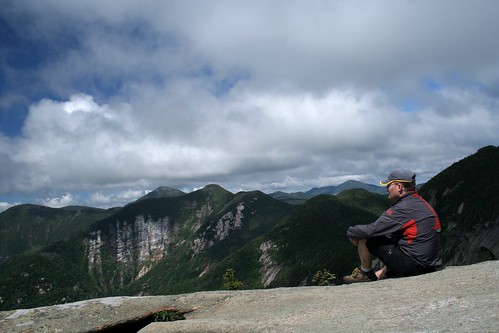
After some while of climbing the “murderously steep trail, the grade finally eased and we pushed out onto the final summit ridge. From here to the top the views opened up and the whole high peaks began to unfold before us. Much picture taking, ohhs and ahhs, ensued and the last stretch went slowly (not because we were tired or anything ;-) but finally we made it to the last few steps. Strangely there is a US Geodetic plate at one point and 100m further along is the Colvin 1880 survey bolt… but which is the top? Makes no matter, I stepped up to both points and Mike graciously offered me a refreshing 46er Ale to celebrate – no small feat considering he hauled the bottle up here. He also mentioned that Bryan had planned to bring one of those cakes where the girl jumps out of it to help me celebrate my finish – sadly Bryan couldn’t make this hike as I would have liked to have seen that.

The summit crew

With the formal celebrations over, much picture taking and a little lunch ensued. The clouds rolled by offering changing views and occasional patches of sunshine. Off in the distance Marcy played her role as the “cloudsplitter” and shone with a new coat of snow and below us Elk lake gleamed with occasional patched of sun. Finally, before we all froze, I built a small snowman and placed him on the summit rocks to reign over his high peak empire. As always though, far too soon, it was time to head down and return to the car. As we left the summit a light snow began to fall and this was somehow fitting – time for fall to end and move on to winter… well perhaps too soon for some but I’ve got my skis waxed and ready to go!

The Dix Overlord and his realm

Once hiking again we all warmed up and apart from one scary moment in which Mike looked to descend several hundred feet in a pinwheeling airborne motion (but thankfully regained control) we made it down the murderously steep section to the base of the slide and the long walk back along the valley. Things moved smoothly along the valley, the colours surrounded us and the day had warmed so although we were running low on energy the walk out was pleasant. Soon enough we were back at Round Pond with the sun setting behind the Dix range and shortly after that I signed out – a newly minted 46er(pending all the necessary paperwork of course). A celebratory pint of beer and we were off on the drive home. A great day hiking and I’m pleased to have got it in before the heavy snows of winter start to fall.

Tawhaus - "the cloudsplitter"

Tuesday, September 30, 2008

Seeing the trees for the forest

So this past weekend was planned to be the big “final hike” to Dix allowing me to wrap up the list of all 46 high peaks in the Adirondacks… but it didn’t work out that way. Unfortunately Hurricane Kyle blocked up the eastern seaboard and held some rainy weather over the high peaks for a little too long. I wasn’t keen to hike my “final” peak inside a cloud so I decided to postpone the hike. In fact most everybody I had invited along had also bailed out so it was an easy decision. That said I hadn’t been out to the woods in a serious way since my hike to Allen mountain over a month ago. I’ve been doing some riding and running in the Gatineau Park at home (ski season is coming!) but a 1 or 2 hour ride doesn’t compare to immersing oneself in the woods. Suffering from some “woods withdrawl” and the campsite already booked anyway I decided that I would head down to Lake Placid. The weather was forecast to be bad. Depending just how bad it turned out I could adjust my itinerary to include low trails or shorter hikes. If it was raining heavily I could duck back to the car and try another area if the rain was sporadic… just play it by ear and roll with whatever mother nature had to hand out. To a degree, this is what I’m looking forward to after I complete the list anyway – no fixed agenda, no high peak I must get to and the freedom to explore at will. Consider this a precursor trip to the ones I will take after the list is done. Bryan also seemed prepared to go with this plan (or lack thereof) so the two of us headed down to the Adirondak Loj on Friday afternoon. We arrived in a heavy drizzle and quickly set up camp. After a quick bite in town we came back and sat around the campfire in a steady rain and debated trail options for the morning over a beverage or two – an inauspicious start!

The next morning we awoke to gray skies but no rain. A quick check of the forecast and we decided to head up Phelps. There would not likely be any views from the top with the low cloud deck but it’s a nice walk and the fall colours were busting out all around us. This would add to Bryan’s 46 list (was I inadvertently coerced to do a list peak?). Additionally it is not a long hike so if the weather turned rainy we could be back pretty quickly and come up with a drier option. As it turns out we didn’t see any rain at all. The hike up was a good one. Phelps is a nice albeit rooty/rocky climb but we enjoyed the ascent along – for the most part - a quiet trail. Much as we expected we got up to the summit to see we were inside a cloud. The clouds in fact seemed to bottom out around 3500ft hiding the big vistas but we expected as much. After a quick exploration for the true summit (Phelps summit is tree covered and unmarked) we sat down on a rocky ledge for a bite of lunch and waited for the clouds to part… and to our surprise they did! Well..., only to a degree did the clouds open up but the valley and nearby peaks started to peak through in resplendent golds and yellows. It was sort of surreal watching the view open and close as the clouds rolled by. As we enjoyed the limited views another couple of hikers arrived… then another… then a few more and a few more… Seems Phelps was on many people’s agendas today and suddenly our rocky ledge was full on crowded and noisy with maybe 25-30 other hikers. The clouds drifted back in and, having had enough of the crowds, we packed up and started down. Once back to Marcy dam some sun had broken through (though the clouds still shrouded the high peaks) so we had some good chances to enjoy the fall colours on our walk back to the camp.

Back at the Loj we took a nice hot shower (a rare treat) and had a cold beverage before rolling into town for some food. After a most excellent burger we came back and got a good fire going to enjoy the rest of the evening. This –without a doubt – beats my usual plan of “hike till dark and then race home in the car”… verry relaxing. Of course some tall tales were told around the fire. No, I don’t truly believe that Bryan wrestled 2… no wait, 3 mountain lions on a paddling trip in Algonquin… but all is accepted around the fire. It adds to the atmosphere and capped off a good day on the trails. While we missed the big views, this was working out to be a good weekend to enjoy the leaves. We were even treated by a neighbouring camper to some live music as he played some guitar and belted out some tunes. This has the potential to be annoying but in this case he proved to be a good singer so it was all good.

On Sunday morning it was even darker than Saturday (but still not raining!). We opted to walk around Heart Lake, which had to be at full peak in terms of leaf colour. On a whim I dragged Bryan up Mt Jo, which is a short but steep little peak next to the campground. At the top we were greeted by stunning views of the inside of the clouds. Ah well, no big vistas this weekend. While the cloud cover tried to break up we had neither brought the lawn chairs nor the cooler so we decided not to wait for the views instead descending and continuing around the lake. Again – more dazzling colours all around us. The lake is none too big so we were back at camp well before noon and decided to pack up and hit the road. As we pulled out of the Loj the heavens opened up and rain started to pelt down – great timing for sure. On the road home we stopped at one of my favourite deli’s in Saranac Lake for a tasty sandwich before making the drive home in the rain. A good weekend to be sure. While there wasn’t much in the way of sweeping vistas we did get a chance to spend some time enjoying the fall colours close up – A chance to see the trees, so to speak, which are sometimes overwhelmed by the forest.

Tuesday, September 09, 2008

P'tit Train du Nord

Pete and I decided to make an excursion on Monday up north to the Mount Tremblant area to take a ride along the P'tit Train du Nord rail trail. This is a 200km long path that follows the rail bed of the old train which used to run from Montreal up to the Laurentians. The trail has been upgraded significantly over other rail trails I have seen. More than just a stone dust path (a number of km are asphalt), the bridges have been upgraded to allow cyclists to cross and there are a significant number of "stations" along the track that have been set up with information, water, bathrooms and parking etc. to provide access and rest stops along the way. There has also been a boom of restaurants and hotels/B&B's at/near these stations to provide riders a chance to have some lunch or stop for the night before heading on along their way - a real full service route.

It is always nice to have a nice long path that is traffic free. The rail trail is of course devoid of steep hills and occasionaly it has long straight boring sections where you can see your path for some distance but I found this route to be a little more interesting than some other rail trails I've been on. It wound its way through the woods a little more following ponds and bogs or cottage lined lakes. There were also frequent villages along the track so there's lots to see. After riding north for a stretch we decided to make the detour to the Tremblant ski station which was quite a contrast to the peaceful trail we had just been on. Then it was back (along a busy road - oops) to pick up the rail trail and head back to the car. This was an interesting outing and I think I'll head back to check out some more of the trail again.

Tuesday, August 26, 2008

Damocles Sword?… or just plain, old Allen

From the beginning of this effort to hike all 46 high peaks in the Adirondacks, Allen has always stood out as a potential deal breaker. I’ve looked at maps, studied online trail reports, read guide books and kept coming to the same conclusion - this one is a little daunting. It’s not an impossibly long hike. It’s not overly tall or hellishly steep… but its just kind of… “out there”. Last weekends hike to Cliff and Redfield is in fact longer – Allen being something less than 30km. Last weekends hike had more vertical elevation gain (Even Cascade - potentially the easiest - has more elevation gain!). But Allen sits off by itself with access along a lonely herdpath deep into the wilds of the park. Last weekend I hiked from Adirondack Loj through Avalanche pass, by Lake Colden and up the Oplalescent. I hiked with literally hundreds of other people on the trail and passed 2 ranger interior outposts – never far from help if anything were to go astray. Allen – ummm, not so much. No campers, no real campsites per se and certainly no rangers. I met only 2 other hikers all day (doing Allen as well). From the minute you step out of the car you are headed away from the popular trails of the high peaks and into the wild, away from civilization…. And that can be unnerving when you are looking at the map. And so over the last three years I avoided it while debating possible strategies. Maybe it would be better to ski part of it in the winter?… no, too cold and maybe not enough snow, maybe an early summer hike would be best?… no, too wet and muddy, perhaps late summer?… No, too hot, Fall?… rife with hunters - too risky, maybe a winter ski… no etc. etc. Now I was down to 2 last peaks on “the list”. I’ve saved Dix mountain for the last, so that leaves me to face Allen. No more chances to avoid it, procrastination has worked its magic.

I hadn’t really expected to head back to the high peaks so soon after last weeks long hike to Cliff and Redfield. I usually take at least a week off in between hikes but as I rode my bike on Saturday I thought that maybe the time had arrived to go get this peak. The weather forecast looked good (a rarity for this summer) so I decided to load up and drive down Saturday afternoon - to the same campsite I had last weekend. I wanted to get started early as the day was slated to be a warm one. With luck I could get to the mountain and up it before it got too hot. At 5 am I woke up to pitch blackness. Hmmm, shorter days, fall must be coming. Hit the snooze but couldn’t sleep so I loaded my pack, booted up, had a quick bite and headed for the trail head. Signed in at quarter to 6 and stepped into the dark woods. Almost immediately I crossed a couple of bridges and could see a heavy fog on the lakes – cold (maybe 12C)… fall must be coming.

The approach trail to Allen although long, is pretty easy going (read flat) and, as it turns out, a good portion of it follows old gravel roads past an abandoned mine and up through a hunting clubs property (with permission). The going was fast and soon I had reached the Opalescent brook. While there is usually a bridge across, this past winters heavy snow run off took the bridge out so the hunting club had kindly marked a good spot to ford the creek without losing the trail. I took my boots off to keep them dry and carefully waded across (knee deep at worst) the very cold brook. Beyond the creek but still on the flat I entered a large area where hurricane Floyd had taken down a huge tract of forest. Now a decade later the loose scrubby bush has started to slowly regenerate. Unfortunately it’s quite overgrown and early in the morning this meant it was wet from the dew. After a mile of walking through this I might as well have walked through the brook as my boots were now soaked. Finally I was back into some real forest and in a couple more miles and I arrived at the bottom of the mountain. I may have covered a lot of ground but there was no real concern of directions – totally clear trail and well marked intersections. I may have been a long way “out there” but there was no threat of being lost.

The climb up Allen goes along (and sometimes in) the Allen brook. Its steep… really steep at times. To add insult to injury the Allen brook is home to a rare form of red/brown algae that grows on the rock surface. This algae – unlike other more typical algae found in the park – is incredibly slippery when wet. It is also incredibly slippery when dry(!) so there’s no winning. Instead you have to make careful foot placements and slowly work your way up. Finally, after crossing a small slide you leave the brook (and algae) behind and make one last push up to the summit ridge and then a short easy walk to the summit sign. I’m here(!) and there is even a little bit of a view carved out of the nearby trees. I sat down and had some lunch and looked at the map… and was immediately intimidated at where I was now sitting… but it hadn’t been that bad to get here so maybe the way out would be okay. After a half hour of lunch and picture taking (and rest) I started down the tricky descent and – too my surprise – was down much faster than I anticipated… and no giant outta control slides down the algae covered rocks. Met the only two people I would see all day at the base and gave them some beta on the climb before going our separate ways.

The walk out was a long connection of milestones that I could remember from the trek in and one by one I got closer to home. The walk across the open area where floyd had cleared the forest was now unbearably hot – no shade to be had and my GPS suggested 34C… but its in a black shell so I don’t know how accurate it is. On the plus side the brush was now dry and I spotted lots of berries (blue, rasp, black etc) along the trail so there was lots of trailside snacking to be had. The ford across the stream now felt decidedly warmer than in the morning but was plenty welcome on the feet. A few more miles and I was back at the car. Quick swim in the Hudson river and I was cleaned up and ready to go…. and it was only 3:30!! This demon hike, this deal breaker, this hellish ordeal…. As it turns out it wasn’t even a long day! I guess that’s a lesson we all need to remind ourselves from time to time. The mind can often make more of something if given the time to do it. This hike is by no means the hardest hike I have done and I’d probably do it again on a nice fall day. It was certainly a treat to get so much solitude after last weekends super highway of hiking trails. It’s “out there” to be sure… but sometimes it’s nice to go “out there” if only to test the waters. Monday morning I got up… no sword hanging over my head… now I can enjoy the fall hiking season.

Allen - 45 of 46

Next stop - on to Dix mountain

Wednesday, August 20, 2008

Reconnoitering in the Central Adirondacks
Sunday dawned under warm sunny skies. I slept late with no particular plans after yesterdays big hike. Lots of cars roared by me on the nearby road – headed to high peak trail heads and long days of their own but I took my time pumping some water, making some breakfast and packing up camp. No rush today. In the end I decided to hike a firetower peak and then do a little exploring around the central part of the Adirondacks. I was quite close to Vanderwhacker mountain so opted for that one. It was a 6 mile hike with a good climb but it would only take me a few hours so that sounded like enough hiking for the day.

The walk started off very gently past beaver meadows but finally it made a sudden tilt uphill scrambling to the summit ridge. Sadly the clouds started to roll in while I climbed but along with the clouds there were cool breezes so they weren’t totally unwelcome. When I reached the firetower the views were quite limited but I enjoyed watching patches of sunshine run up and down the nearby hillsides for a while.

The descent was fast and soon I was off driving through the central part of the park scoping out trail heads and even an x-c ski center I’d heard about but never visited (no snow there yet ;-). I debated stopping at the Adirondack museum in Blue Mountain lake but – with cloudy (sometimes rainy) weather - the crowds at the museum were pretty heavy. Overall I enjoyed my drive and discovered there’s a lot to see further in to the park so I’ll have to come back and explore some more.

Tuesday, August 19, 2008

A long hike to 2 high peaks

The weather looked good this weekend so it was time to get back to the Dak’s for a little climbing. I’m hoping to finish off “the list” this year and the weather has not been cooperating of late so spying a reasonably dry looking day made me jump at the chance…. As it turns out I would NOT be alone in this thinking. I took a leisurely drive down on Friday after work to the usual camping spot at South Meadow and found it almost full to overflowing. Managed to squeeze in to a spot and got a solid nights sleep before rising with the sun. I had a long day planned heading for Cliff and Redfield so I decided it would be worthwhile to cut a little total distance by parking at the Loj parking lot. Despite the $9 parking fee this would shave a mile off the total hike and every little bit would help. The walk from the Loj to Marcy dam and up through the Avalanche pass was mostly uneventful – lots of campers at the dam slowly stirring from their sleep and gearing up for their day. More of the same as I strolled around Lake Colden. But for the most part the trails were quiet. The trail up the Opalescent creek is one of the more beautiful walks as it skirts along the roaring brook. At a few spots the trail sits on loamy ledges and you can peer down into narrow, deep chasms where the brook crashes downhill. It makes for a nice walk and the trail was in pretty good shape in spite of all the extra rain we’ve had (read typical mud pits only). When I crossed the Uphill brook I had come to the herd paths for Redfield and Cliff - finally the start of the real work. Three hours of hiking to get to the bottom of where it starts to go up…. hmmm gonna be a long day.
Ranger rowing across Lake Colden in the morning


I had heard that you should do Cliff first and then Redfield (cause its easier) but I sometimes prefer to go against the grain so I opted for Redfield first – it’s a lot higher afterall - how can that be easy? The herdpath for Redfield is actually quite nice. It also meanders up a brook and sometimes climbs through it with vignettes of the high peaks through the trees. It starts off slow and gets perpetually steeper but - apart from the increased heart rate - is never overly taxing. I arrived on the summit to find the beautiful sunny skies replaced by dark forbidding clouds (fortunately somewhat higher than the summit so there were still some views to be had). I sat for a while and a family (Dad, son and daughter) joined me on the summit. The son was concerned about the somewhat dubious lunch that Mom had packed for them… not quite a sandwich but sort of the makings of one. I was about to mention that my Mom hadn’t made me any lunch at all!… but the Dad was quick to point out that their Mom had at least been good enough to pack something to eat… Good point Dad. Unfortunately the clouds started to lighten their load on our heads and a light rain began to fall. I opted to start down and 2 minutes after I left the summit a mighty thunderclap echoed through the peaks – yikes… time to get low! As I started to motor down (the family in hot pursuit) the skies opened up and a heavy shower soaked me but as quick as it started it stopped… and soon the sun was shining again. Good news – hopefully the trails didn't get too soupy as I wouldn’t want to have to come back for Cliff.

As I descend I could see Cliff through the trees and it was in perfect sunshine so I pressed on with the days agenda. Cliff is a different sort of mountain… its not actually 4000 ft but, due to a surveying error, was originally on the list and has stayed there ever since. The approach starts out through a very swampy section of trail (just to get your boots good and muddy) and then – much as its name suggests – it goes up a series of very steep cliffs and ledges. It’s probably the most challenging technical climb I’ve had in all of the 46 to date. It requires all four limbs to come into play. I was sure to keep 3 points of contact at all times as a fall out here would be a bad thing. Careful slow progress and you make your way up only to be greeted at the top by another large, deep mud pit (to prep your boots for the down climb). The top is relatively flat but the true summit is at the other end from the cliffy ascent. The mountain was hit very hard by Hurricane Floyd in the ‘90’s so its quite surprising that any trail could be cut through the mess of blowdown at all but eventually you arrive at the summit sign (with more views of blown down trees). The descent is no easier so again slow careful progress was the order and soon enough I was down the mountain with just the walk out to go. I was dreading this part of the hike (death marches are seldom fun) but it actually went quite well. The closer I got to the parking lot the better the trail condition was and the faster I was able to go. Maybe there’s something about “the horse smelling the barn” there…. I’m just sayin’. In the end I hiked about 10.5 hours and covered something north of 30km with about 4000 foot gain. Good day in the peaks and two more off “the list”.

Allen Mountain - calling to me?

On my hike in the morning I had seen very few people hiking – too early perhaps. I did run into a few groups on the herdpaths, which is more than usual. Most of hese hikers had camped at Colden, Flowed lands or even the Uphill brook leanto to give easy access to the trails. As I descended the peaks to Lake Colden I started to see how precious a sunny day in the Daks (save for one brief thunderstorm) can be as the crowds started to mount. With campsites already pretty full I saw line after line of college aged backpackers heading in, families – all in tennis shoes and no packs - hiking to the Avalanche pass, climbers and hikers at every turn (some with maps, some without). Amidst it all were wild-eyed rangers telling anyone who’d listen where they could stick their tents. I guess there hasn’t been that many good weekends in the summer and everyone seized the opportunity all at once. When I stumbled out at the Loj I found 12 pages of names in the sign in book from where I had signed in the morning. Clearly a busy night – and probably good pickins’ for the local bear population. For me, I opted to grab some food in town and then headed off to a secret and quiet campsite. I was sound asleep by 9pm and hit the snooze button the next morning.

Redfield - 43 of 46
Cliff - 44 of 46


Avalanche pass on a sunny afternoon

Wednesday, August 06, 2008

Nascar Reggata...err Racing

The August long weekend is time for the summer road trip to take in some auto racing on Ile St. Helene. The island is quite a little oasis in the heart of Montreal and is likely a very relaxing spot on all but 2 weekends a year. On this weekend the Nascar Nationwide series had brought their traveling road show to town and brought along the Grand Am and Canadian Tire series racers as companion races for the weekend. It makes for a great couple of days at the track watching practice and qualifying sessions, strolling through the paddock areas before the green flag drops on some great racing. This year I drove down with a friend from work and we met up with some colleagues from Montreal to take in the show.

Friday was mostly practice and qualifying on the track with the Grand Am series race to close the day. The weather was mostly overcast but still pretty warm so we appreciated the lack of sun that would have barbequed us in the grandstands. Time at the track on Friday is always a little more relaxing - a few less fans and more of an opportunity to walk around and check out some of the other parts of the course. Time in the paddocks gives you a great chance to see the cars up close before they head out to the track for their races and with a bunch of Canadian drivers qualifying for the races there was a good buzz in the crowd. Post race we spent a very civilized evening at a local brasserie preparing ourselves for Saturdays action.

Saturday dawned sunny but the forecast looked grim. The morning race went off with out a hitch and some exciting racing led local racer Andrew Ranger to victory lane, much to the delight of the fans. As the big show drew near so did dark threatening clouds. The drivers introductions were punctuated with lightening flashes on the south shore and as the cars raced a handful of laps the skies suddenly opened up. It was like someone turned a bucket of water on our heads! The race took an enforced break and drivers put on rain tires while the track crews tried to sweep away the flooded sections of the course. Soon enough the racing was back on – the first Nascar race ever using rain tires. A rear brake light was mounted and some cars had a windshield wiper while others opted for a heavy coat of Rain-X to clear the windshield. To my surprise the fans hung tough, donning their ponchos and raingear and waiting for the race to restart. And when it did the racing was brilliant as the rain tires worked well under occasional light showers. Finally another deluge hit and didn’t look like it would let up. With night falling and steady rain the race was called (short of the full distance but long enough to be official) but no one left disappointed – a good show all around.

Close battles on the slick track


Sunday morning I headed to Maniwaki to visit with a few friends who had congregated at the cottage for the long weekend. The weather was a little better with short passing showers mixed with patches of sunshine. Lots of chores got accomplished with many hands available - chopping firewood, cabin renovations, making beer runs (hey! who got that easy task?!) There was of course plenty of time for a little swimming and waterskiing – the cottage is not all work afterall. Nice quiet spot after a weekend of noise at the track.

Time for a swim...wait a minute have these kids been swimming while we worked?

Tuesday, July 22, 2008

Ironman Lake Placid
After Saturdays hike, I stayed overnight in Lake Placid to check out the Ironman competition on Sunday. I wanted to see the race out of curiosity as well as see how another big event like this handles the logistics that I deal with in the spring. After a tour of the course Saturday evening (to see any course prep), I got an early start to see how set up and road closure were handled. Of course when roads close I couldn’t drive around much so I had wisely brought my bike to cycle around and see how it all went off. After a bit of a tour on the bike I headed over to the Lake in town to join the crowds in watching the swim start. Quite a scene watching 2400 swimmers churning up Mirror lake and for each competitor there is at least 3 or 4 "Ironfans" on the sidelines in support - Big crowds.

As the pros finished their second lap (of 2) in the lake I ducked around to get a good position to see them coming out on the bike for the second leg of the race. Just as the first competitors took to the bike course the rain began. Sprinkles, then drizzles, then pounding, dousing rain…. Then more rain (in cups and buckets)… and more in the “cats and dogs” variety… And then more and more and more. In fact… it rained (at times really hard) all day long. Not a huge problem for the competitors who would appreciate the cooler weather although visibility and bike handling would be a bit of an issue in the pounding rain. No, this day would test the mettle of the "Ironfans" and volunteers who would spend many hours standing around waiting - cold and wet. I heard a lot of comments like "I saw him go by, lets get out of here..." amongst the crowd. I was quickly drenched and was worried my camera would get soaked so after most of the riders were on their way on the bike leg I sloshed back to the car and got changed into dry clothes.

Rather then head home (it was only 9am at this point) I decided to drive the bike course. The Police keep the opposite lane of traffic open on the 56 mile loop of highway the racers use so I did a clockwise drive of the course while the riders went counter clockwise. I even got to see the leaders working their way around for the second lap as they descended through the Cascade pass. Back in town I took my camera and my umbrella (which would have been useful in the morning) and wandered back into town. The rain was still pounding down but it was a great opportunity to see the riders deal with the wet roads. On a couple of tricky wet corners it was immediately clear who had trained in the rain and who were fair weather riders. I didn’t see any spills though as the poorer bike handlers typically slowed to a crawl before gingerly edging around the corners while the better bike handlers carved their turns flawlessly. Before long the leaders were back in town and ready to head off on a marathon…. 2.4 mile swim, 112 mile ride and 26.2 mile run, man is that a tough day.


The rain was still pounding down and the rolling streets in town were becoming cascades…more wet feet but I had one last pair of dry shoes in the car (umbrella was working like a charm though). The Lake Placid brew pub had a tent on course and was cooking up a little barb-q so I partook in a little lunch while the runners ran (and lots of cyclists still cycled). Must be hard to run by that tent after 8, 10, 16+ hours on the course and smell the brats cooking up yet be unable to stop… kinda cruel really. Finally the leaders came in to take the victory and I took my leave to drive home. Wet day but an interesting one so I was glad I hadn’t bailed out after the initial soaking.

Monday, July 21, 2008

Porter Cascade traverse
The weather looked good on Saturday so Mike and I headed down to the Peaks to get in another hike. This time we opted for a non-list peak… too many list peaks of late so it was nice to do a hike just to explore some new trail and enjoy the day – no real agenda no fixed summit to bag. I decided I’d stay down on Sunday to take in the Ironman competition so we drove down in separate vehicles… which of course means we could try a traverse. We weighed our options, bounced a few ideas around and settled on Porter and Cascade. Porter and Cascade? Aren’t they “list peaks”? Indeed, but both Mike and I had them checked off. With 2 cars we could take the lesser used approach from the Keene valley, traverse these two peaks and then drop down the short, direct trade route to the Cascade pass where we would leave the second car.


Hazy Keene valley

With Mike’s car in the Cascade pass and we drove around to the Marcy airfield in the Keene valley to get to the other trailhead. The climb from the Keene valley has an extra 1000ft of climb and is a significantly longer approach which is why it is seldom used but the trail is a good one. From the parking lot we started to climb, and then climbed and climbed and climbed some more. The day was hot and muggy which seemed to sap my energy faster than normal – glad this wasn’t one of the marathon hikes I have left on the “list”. Once we got to the first summit of Blueberry mountain we were both pretty beat but this mountain had a treat for us. As its name suggested it was covered with wild blueberries – snack time! Also along this summit ridge we came across one of the largest high ridge erratics I have ever seen. I of course had to climb it and fortunately didn’t snap both my ankles as I lept off.

No time to rest for long though as we still had more climbing to do. Here the humidity gave way to actual rain… then some sun (which pumped up the humidex to new highs) and then more rain. As we crested Porter the rain was coming down in sheets (no views) so we didn’t stay long but instead ducked into the trees for a little cover. Fortunately as we walked the ridge to Cascade the sun came out and we enjoyed some good summit time. It was still a little hazy and the clouds (and birds) were blowing around above us but on a day like this you take what you can get.

Cascade is a relatively easy peak to get to on the main trail from the Cascade pass and as a result a lot of non-hikers come up to try out high peak hiking… and today was no exception. Converse high tops and high tech running shoes, denim to basketball shorts, overstuffed packs to no pack at all… the tourist crowd has all the bases covered but anything that gets people up to enjoy the high summits is a good thing.

Finally we started down and as we did it started to rain again… I moved faster wanting to get off trail without getting too wet… but of course forgot that it was Mikes’ car in the pass… so I had to wait for him to exit the woods(with his keys) before we could load up and drive back to my car. It wasn’t too long though and soon we had cleaned up and were enjoying a beer and a burg on a patio in Keene as it had cleared up nicely in the evening. Good hike and a nice traverse.

Sunday, July 06, 2008

Holiday hike in the Dix range

With a clear forecast for the weekend I decided to make another run down to the Adirondacks to do some climbing. With luck I’d get clear skies and maybe the bugs had died back a bit allowing for some precious summit time. I loaded my car and started driving Friday after work. On the way down I came across a number of town parties underway – July 4th of course – but I had a few miles to cover so I kept rolling. As I approached the village of Long Lake I found I was just in time for the fireworks and an impressive show it was. Turns out the villages in the Park trade off the “big party” from year to year. This year it was Long Lakes turn which meant that – by enjoying the fireworks as I pulled into town - I also had to cope with the traffic as all the spectators (coming from a 100 miles in each direction) scurried back to their cars to get home after the last “rocket burst in air”. Long Lake usually takes 5mins. to drive through but tonight it was like Sussex drive last Tuesday night(Canada Day) – a free for all! Forty minutes later, unscathed, I headed off to make camp and get some sleep.

I woke up pretty early on Saturday and wanted to make time to the parking lot. My goal today was the Dix range – a cluster of 5 peaks in the southern end of the high peaks area. The entry point today would be the Elk Lake lodge parking. It’s on private property but they have a small public lot for hikers to use. I wanted to get a spot to park before it filled up as I hear it’s a popular hike and this is a holiday weekend afterall. By 6am I was on trail and I made good time until the slide up Macomb. Here the herdpath enters a long rocky/gravely slide and climbs it for close to vertical 1000ft. While modestly tough going, the views also open up and I kept stopping to enjoy the view in the early morning sun (stopping didn’t hurt at letting my heart rate drop either). With the slide behind me I summited Macomb mountain and with that the bulk of the climbing was done. Once on the ridge the trail (a herdpath) goes up and down the group of peaks but never loses a lot of elevation so from then on the climbs were small. The views on the other hand were anything but small and it was a glorious day to enjoy it with bright sunny skies.

Three peaks in the bag I met my first (and only) hikers of the day. I was on my way back (on an out and back section) so they had a little more distance to travel but we chatted for a spell and compared notes. In the end I didn’t see them again so I had the whole range mostly to myself. Sadly as I topped out on Hough I found I was not entirely alone as my old friends the blackflies came out to welcome me. They weren’t really aggressive – more geriatric blackflies - but they were still annoying non the less so I ate and photographed quickly before heading down for the day. The heat of the day was starting to ramp up anyway so it was time to get down and call it a day.


The Beckhorn off the summit of Dix (as taken from Hough)

With the peaks behind me I though the excitement of the day was over but as I approached my return trail to the car I was attacked by a very aggressive grouse. Usually grouse just fly off into the bush – startling the bejezzus out of you – and are gone. In this case the grouse came at me like those mini dinosaurs in Jurrassic Park - the ones that killed Neuman – puffed up and hissing and spitting like crazy. This of course startled the bejezzus out of me but it was far from gone. After two brief backwards dashes from this insane beast I collected my wits (and may even of started laughing). Time to teach this overgrown chicken what a carbide tipped hiking stick can do to its puffed up self… but then I noticed in its anger it had worked its way off the trail so a few more yells at it (and a few more hisses and spits at me) and I was free to scoot by and carry on my way. First animal attack in a while but certainly a memorable way to end the day.


Macomb - 39 of 46
South Dix - 40 of 46
East Dix - 41 of 46
Hough - 42 of 46